GIS and
digital documentation
Melkoya project
have been using digital methods for measuring, documentation
and analysis.
GIS (Geographical Information Systems)
are collections of:
- Hardware
- Software
- Data
- Methods for treatment of data
The software and the maps we use are
the basis for the visual representation of the procedures
in the system for treatment of data. Still, GIS is not
primarily a package for presentation of digital maps and
distribution of objects. The core elements of GIS are:
- Data capture: mapping with
totalstation, GPS
- Data storage and convertion
- Statistical analysis
- Visualisation
- Geographical analysis
GIS is a database made for collection,
storage and analysis of objects and phenomena where geographical
placement is an important or determining characteristic
for the analysis.
The essence of GIS lies in its ability
to analyse data and transform it to interpretabable information.
The quality of the analysis is dependant of the quality
of the base data, like it is in all other aspects of data
treatment. Low standards on maps and methods for documentation
in the excavation give low standard on the analysis.
 More
about GIS and archaeology can be found here
More
about GIS and archaeology can be found here
The software used
for analysis is ArcView 3.2
Technical
solutions
The project has used the following
hard- and software in our collection and analysis of
data :
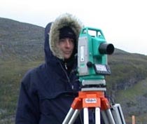
Measurement took place in
almost all kinds of weather
Digital documentation
in the field
Structures
The totalstation was used for collection
of data about the localisation of structures in the field.
These were plotted onto maps which were continously updated.
We were then able to have maps showing us the relation
between the different structures, and could be used for
the planning of the excavation as it took place.
Grid systems
The totalstation was used for construction
and maintenance of the local grid system, and for placement
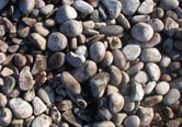
of local grid in the national system. Specially in Sundfjaera
we were digging in a complicated local topography, with
boulders, uneven and rocky surfaces and marked differences
in levels. Here the totalstation allowed us to quickly
and accurately place supplementing coordinates for the
excavation, and to plit important findings and other elements.
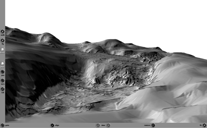
Microtopography
A microtopographic measurement was
done of dwelling 8 in Sundfjaera. Here we measured every
20 cm. The intention was to make a digital model of how
one of the many dwellings were placed and orientated in
the landscape. We cose this dwelling because it is situated
in an old beach surface and has realtively marked walls
so it should be possible to reconstruct it three-dimensionally.
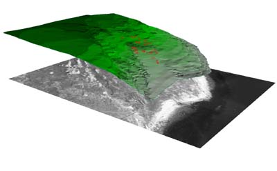
Macrotopography
We wanted to use digital methods
of documentation to try to reach a better understanding
of the relationship between past settlement and past landscape.
To achieve this we wanted to document the landscape as
it appeared when the dwellings were in use. This meant
that the topography had to be documented after the removal
of several thousand years growth of turf.
In Sundfjaera we therefor did a macrotopographic measurement.
The excavated area was measured after mechanical deturfing.
A total of 7-8000 points were recorded.
The result is the documentation of the area for the future,
and a digital model which illustrates how
the landscape looks like under the soil.
More
about landscape-modelling in the project can be found
here
Analysis and
visualisation
In the post-excavational
stage the project is working with GIS for analysis and
visualisation in the following areas: